|

A unique approach to Historical Mapping
One Historical Map for Each and Every Year in Recorded History
Interactive Historical Atlases on CD and DVD
|
|
All NEW and Improved
Better Browser Compatibility
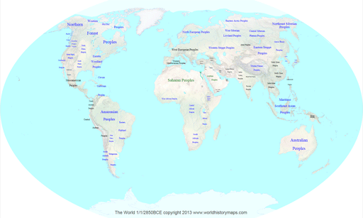
3000 BCE to the present
With Major Tribes and Peoples
Scaleable and zoomable
With popup information
Indexed by date, country, selected rulers
Map movie (World 3000 and North America only)
|
|
Visit our
companion web site
civilwarhistorymaps.us
One map
for each and every day
of the Civil War
and much more
|
Help on viewing these Historical Maps of the
World
This help file was last updated May 10, 2013.
Recommended Web Browser: All of the major browsers are now supporting SVG and we have upgraded all our maps to a common format which will work better. We have tested 5 major browsers on a variety of systems. The following table lists our results. Your results may be slightly different depending on how options are set. Most of our testing has been done on Windows PCs, results on Mac computers may vary. Look at the samples to see how the maps will work on your system.
| Feature |
Internet Explorer |
Firefox |
Opera |
Chrome |
Safari on PC |
ipad |
Surface |
|
|
|
|
|
|
|
|
| Map Display |
Y |
Y |
Y |
Y |
Y |
y |
y |
| Popup Information |
Y |
Y |
Y |
Y |
Y |
y |
y |
| Find Text |
hilite |
hilite |
hilite |
no hilite |
hilite |
na |
na |
| Zoom in/out |
ctrl +/- |
ctrl +/- |
extension uses mouse wheel |
no |
ctrl +/- |
pinch |
pinch |
| Pan |
scrollbars |
scrollbars |
drag |
scrollbars |
scrollbars |
drag |
drag |
The Opera extension for zooming and
panning is available for free at
https://addons.opera.com/addons/extensions/details/svg-zoomnpan/1.1/?display=en
If someone knows of a zoom extension for Chrome please let me know.
Popup Information:
Information about the country that will appear in a popup
window as the mouse hovers over a name. There may be a slight
delay in appearing.
General Information:
These maps are designed to work as follows. For the maps on the CD, once you insert the CD the file index.htm should open in your default web browser.
This will display the master index with years and clicking on any one of them will bring up the svg file for that year.
If you copy all the files on to your hard drive the same procedure should work if you start from the index.htm file.
If the index does not open automatically you will then need to open the index.htm file in your browser.
You can do this by using the file menu, or by dragging the file into an open browser window, or by right clicking on the index file and selecting open with.
You can open any of the svg files directly by the same means.
For each year there is an svg file.
The only reason that you would not be able to open the svg file directly would be that you have some other program defined as the default program to open svg files.
SVG is a standard of the World Wide Web Consortium but each browser has defined its implementation differently.
Note: These maps require significant
system resources and may not work properly on older computers.
Performance will also be slower when viewing the samples on the
web. For fastest performance we suggest copying the contents of
the CD to your hard drive. The maps display in layers and a slight
delay may be experienced while layers are being drawn.