See Today in the Civil War - 150 Years Ago
Maps and Chronology
A special feature from civilwarhistorymaps.com
Visit our companion website
www.worldhistorymaps.com
for Interactive Historical
Atlases of the World
Maps of Your Civil War Ancestor
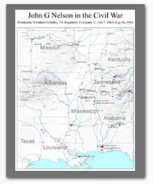
Battles and skirmishes your Ancestor fought in.
Places he was at during the war.
Other battles and skirmishes that occurred during his time of service.
Narrative of his service and other options.
Maps are based on the our data for battles and skirmishes, matched to Regimental Histories in the NPS on-line database of Civil War Soldiers and Regiments (from Dyer's Compendium), The Compendium of Confederate Armies, the Supplement to the Official Records, and other sources. Additional details will be incorporated if you provide them. We work with you to get the map you want.
Maps are priced from $95. Additional charges may apply depending on options selected. See Order Form.
Interactive Atlas of the Civil War on DVD-ROM
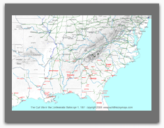
The DVD has a complete set of 1,694 maps for the entire United States, complete sets for each of the Confederate states except Texas, each of the Border States, and both Northern and Eastern Virginia. The DVD also has separate campaign maps plus detailed individual state and unit (army level) information listing who was in command and campaigns and battles they participated in.
Each map shows the location of almost all skirmishes and minor actions on the day they occurred.
We do not believe that this information can be found anywhere else at this level of detail in time.
Locations of armies are displayed, and distinguished between stationary armies and armies in motion
States, cities, and towns are colored according to who was in control on that particular day.
This shows the fluid situation more clearly than maps which show a front, or line of control. Some towns changed hands frequently
within a matter of days.
Army Departments and their borders are shown.
These are hardly ever seen on Civil War maps.
There is a calendar index for each set of maps and a quick index on each map.
This allows you to quickly find the day you are looking for or go to another day.
Each map also has a chronology of what was happening on that day.
All maps are interactive allowing you to zoom in for more detail or move the map around.
As you roll over names and symbols, popup information will display.
States, Departments, and Armies link to a new page with more detailed information.
Map layers can be turned on or off allowing for different views.
The maps will display on your computer in the Web Browser. We are now recommending the Opera web browser for the best viewing of our maps. (For more information please see help)
Atlas of the American Civil War
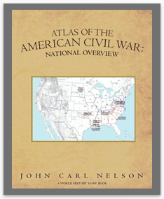
See the Civil War as never before in John Carl Nelson's fascinating Atlas of the American Civil War, an exciting new series of progressively more detailed atlases with maps based on GIS technology.
National Overview and concentrates on the big picture behind the war, from the campaigns, operations, and conventions to the major battles. The first in an exciting new series of progressively more detailed maps and atlases, National Overview is a visually stunning way to make you feel a part of Lincoln's own war room. A must have for any student of American history or reenactor, National Overview is as exciting as it is educational.
Calendar for Civil War Sesquicentennial
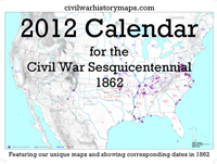
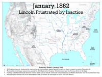
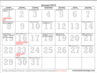
New from civilwarhistorymaps.com, a 2012 calendar created especially for the Sesquicentennial of the American Civil War. This calendar features our unique Civil War maps for each month and short text summaries of what happened that month in 1862. Key events of 1862 are shown on the corresponding days of 2012. In addition the calendar shows birthdays and ages of prominent Civil War figures as well as deaths that occurred.
Each map shows the campaigns and major operations that were active during the given month. No line of control is shown since there really was none at any point. Armies were not large enough to establish a continuous front and units frequently operated deep into enemy territory. Major battles, and all skirmishes and minor actions that occurred are shown on the maps but not named. Major battles are those designated as such by the National Park Service and all of them are noted on the calendar.
American Civil War the Map Movie
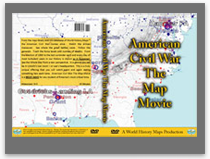
View a sample clip on YouTube.
From the map library and GIS database of World History Maps™ the American Civil War comes alive. Watch the armies maneuver. See where the great battles were. Follow the generals. Track the force levels and number of deaths. From the election of 1860 to last surrender each and every day of the most turbulent years in our History is shown as it happened. See the Whole War from a new perspective. In a glance you can be in Lincoln's war room - or Lee's headquarters. This is a truly unique offering that you will watch again and again seeing something new each time. American Civil War The Map Movie is a MUST HAVE for any student of America's most critical time.